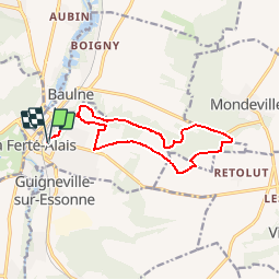
16.8 km | 19.2 km-effort
la ferté alais la sablière
mdsaintjalmes
User
Length
12.5 km
Max alt
146 m
Uphill gradient
173 m
Km-Effort
14.8 km
Min alt
80 m
Downhill gradient
171 m
Boucle
Yes
Creation date :
2015-03-13 00:00:00.0
Updated on :
2015-03-13 00:00:00.0
3h15
Difficulty : Medium
FREE GPS app for hiking
About
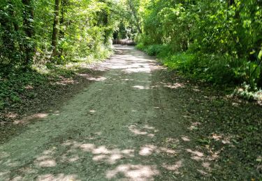
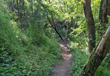
Trail Walking of 12.5 km to be discovered at Ile-de-France, Essonne, La Ferté-Alais. This trail is proposed by mdsaintjalmes.
Description
Départ : parking de la sablière
Positioning
Country:
France
Region :
Ile-de-France
Department/Province :
Essonne
Municipality :
La Ferté-Alais
Location:
Unknown
Start:(Dec)
Start:(UTM)
452181 ; 5370177 (31U) N.
Comments
Trails nearby
Autour de Lardy en VTT
Mountain bike
Medium
(1)
Lardy,
Ile-de-France,
Essonne,
France
31 km | 38 km-effort
2h 4min
Yes
Chemin des Marais
On foot
Easy
Itteville,
Ile-de-France,
Essonne,
France
14.3 km | 16 km-effort
3h 38min
No
Les Marais de l'Essonne 29,5 km
Mountain bike
Easy
(1)
Baulne,
Ile-de-France,
Essonne,
France
30 km | 33 km-effort
2h 12min
Yes
Boucle mondeville par videlles
Walking
Very easy
(1)
Mondeville,
Ile-de-France,
Essonne,
France
16.1 km | 18.6 km-effort
4h 2min
Yes
V2foretxhospitalierexdexlaxcoudrayexballancourt-sur-essonne
Walking
Medium
(1)
Ballancourt-sur-Essonne,
Ile-de-France,
Essonne,
France
6.1 km | 7.9 km-effort
1h 47min
Yes
Bouville
Walking
Medium
Bouville,
Ile-de-France,
Essonne,
France
8.4 km | 10.3 km-effort
2h 20min
Yes
Boutigny-sur-Essonne
Walking
Medium
Boutigny-sur-Essonne,
Ile-de-France,
Essonne,
France
6.4 km | 8.5 km-effort
1h 56min
Yes
Ballancourt-sur-Essonne
Walking
Medium
Ballancourt-sur-Essonne,
Ile-de-France,
Essonne,
France
5.7 km | 7.4 km-effort
1h 41min
Yes
Je suis intéressée par ce circuit - pour unenovice c'est très utile.Merci à tous